vector-geology Documentation
- Release:
0.3.dev17+g93b9dad.d20241008
- Date:
05 December 2024
- Source:
Vector Geology Repository
Overview
Welcome to the Vector Geology repository, a collaborative platform integrating a suite of geophysical and remote sensing data processing tools developed by the Vector consortium . This repository serves as the central hub for accessing, understanding, and utilizing a range of software packages designed for geological exploration and research.
Key Features
Integrated Toolsets: Collection of diverse code packages developed and maintained by Vector consortium members, offering a wide range of functionalities for geophysical data processing.
Comprehensive Tutorials: Step-by-step guides demonstrating typical workflows, from data input to advanced inversion techniques.
Extensible Framework: Designed to accommodate a variety of datasets and scientific inquiries, with the flexibility to adapt and expand to meet specific project needs.
Collaborative Development: Opportunities for users to contribute, enhancing the repository with their expertise and feedback.
Getting Started
Prerequisites
Basic understanding of geophysical exploration techniques and remote sensing data.
Familiarity with programming languages and tools used in the repository (e.g., Python).
Note!
Note that vector-geology is still in early days; do expect things to change.
Explore Our Guides
Galleries
- orphan:
Vector Geology Examples
Welcome to the Vector Geology Examples section. This space is dedicated to showcasing the diverse capabilities of the Vector platform. Here, we illustrate not only what you can achieve with Vector but also guide you on how to implement these techniques effectively. Our examples are categorized into distinct areas:
Readers and Parsers: Understand how to interpret and utilize various data formats.
Structural Modeling: Explore methodologies for constructing geological models.
Geophysical Forward Engines: Dive into the simulation of geophysical processes.
Probabilistic Modeling: Grasp the nuances of probabilistic approaches in geology.
Each tutorial is designed to provide a practical understanding of Vector’s functionalities. While our goal is not to cover every feature exhaustively, we aim to offer a comprehensive overview, demonstrating the potential applications and methodologies. As each geological setting may require unique approaches, we encourage you to delve into the repository’s documentation and codebase to uncover the most suitable tools and techniques for your specific needs.
🌱 A Living Gallery: We actively encourage contributions and suggestions. If you have an application, a novel use case, or improvements to existing examples, we welcome your input. This collaborative approach ensures that the gallery not only stays current with the latest developments but also resonates with the needs and discoveries of our users.
So, whether you’re here to learn, explore, or contribute, the Vector Geology Examples gallery is your starting point for a journey into the depths of geophysical data processing and analysis.
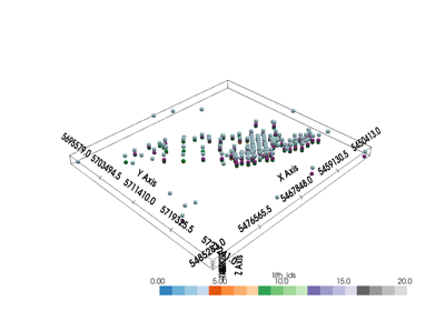
Readers and Parsers
Effective data analysis in geophysics begins with efficient data handling. This section is dedicated to demonstrating the use of specialized libraries to read and parse various data formats commonly encountered in the Vector Geology project. Here’s what you can expect:
Format Recognition: Learn how to identify and handle different data formats used in geophysical and remote sensing research.
Library Integration: Understand how to leverage specific libraries to read these formats. We cover a range of tools, emphasizing flexibility and ease of use.
Data Conversion: Discover methods to convert raw data into xarray structures, a powerful tool for handling multidimensional datasets. This step is crucial for streamlining post-processing activities.
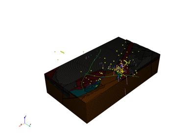
Reading OMF project and exporting it to Subsurface: Example 1

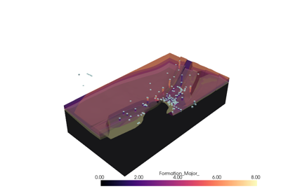
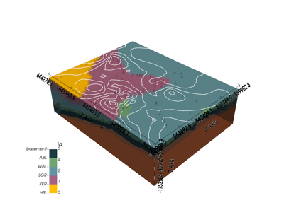
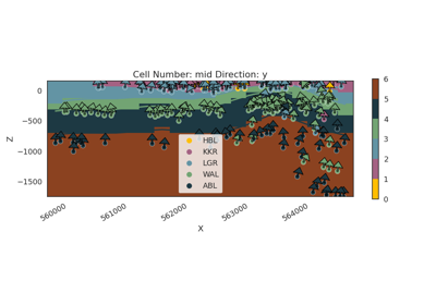
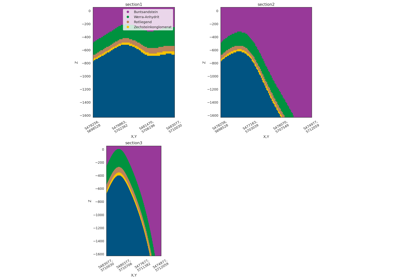
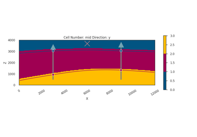
Structural Modeling
Delve into the world of 3D subsurface modeling with our Structural Modeling tutorials. In this section, we focus on harnessing the capabilities of gempy, a powerful tool developed by a partner within the Vector consortium. Here’s what these tutorials offer:
3D Subsurface Modeling: Learn the intricacies of constructing detailed 3D geological models. We guide you through the process of transforming raw geophysical data into a comprehensive three-dimensional representation of the subsurface.
Using gempy: Discover how to effectively use gempy for your modeling needs. Whether you are new to this tool or looking to refine your skills, our tutorials are designed to cater to a range of expertise levels.
From Data to Insights: Our goal is to empower you with the knowledge to not just create models, but also to extract meaningful insights from them. These tutorials bridge the gap between raw data and the decision-making processes in geology.
Prepare to enhance your understanding and skills in geological modeling with a focus on practical, real-world application. By the end of this section, you will be equipped to construct and interpret complex structural models, a crucial skill in the field of geophysical research.
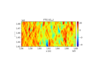
GeoPhysics and Inversion
Our tutorials are crafted to guide you through the process of applying geophysical forward modeling and inversion techniques, using advanced tools like gempy and simpeg. Here’s what you can expect:
Geophysical Forward Modeling: Learn how to transform structural models into geophysical models. These tutorials will show you how to use gempy to simulate geophysical responses based on your structural models. Whether you are a beginner or looking to refine your modeling skills, these guides offer comprehensive insights.
Classical Inversion Techniques: Dive into the world of geophysical inversion using the powerful simpeg package. We’ll demonstrate how to apply classical inversion methods to geophysical data, turning observations into meaningful geological insights.
Current Implementations: As of now, we have explored two areas:
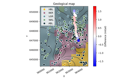
Bouguer Gravity: Understand the principles and application of Bouguer gravity in geophysical modeling.
Gravity Gradiometry: Explore the use of gravity gradiometry in deriving detailed information about subsurface structures.

Predicting P-Wave Velocity from Hyperspectral Data
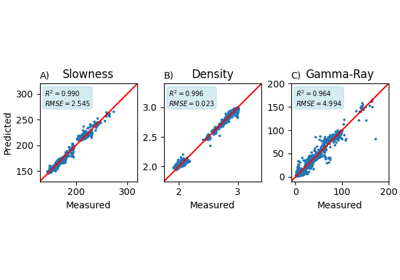
Multiphysics property prediction from hyperspectral drill core data
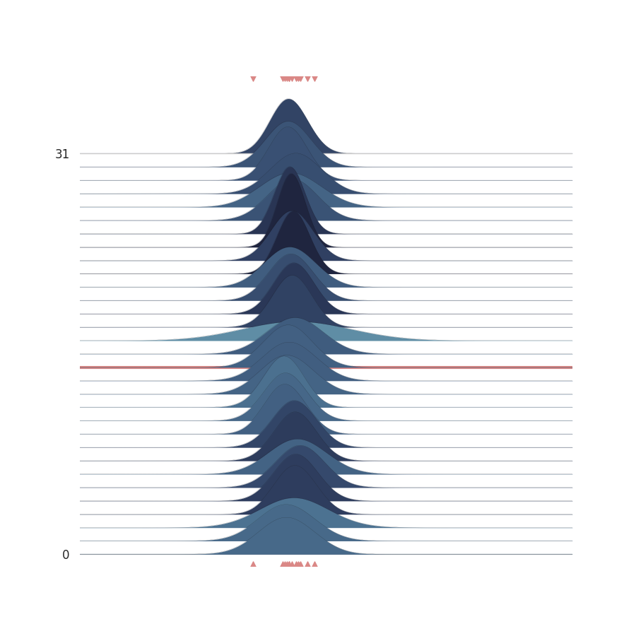
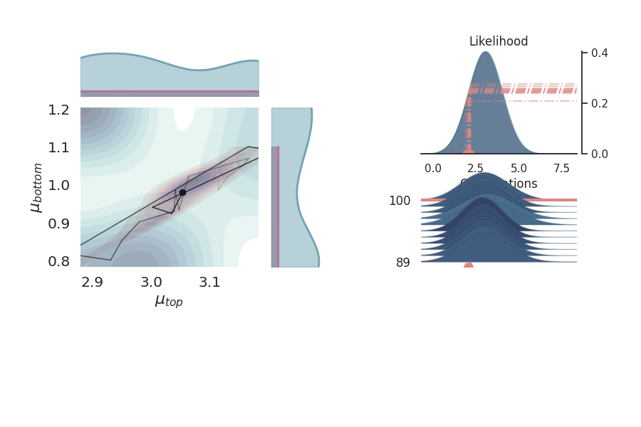
Probabilistic Modeling
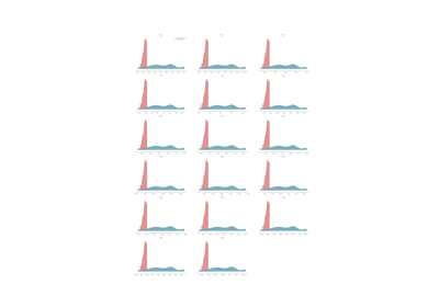
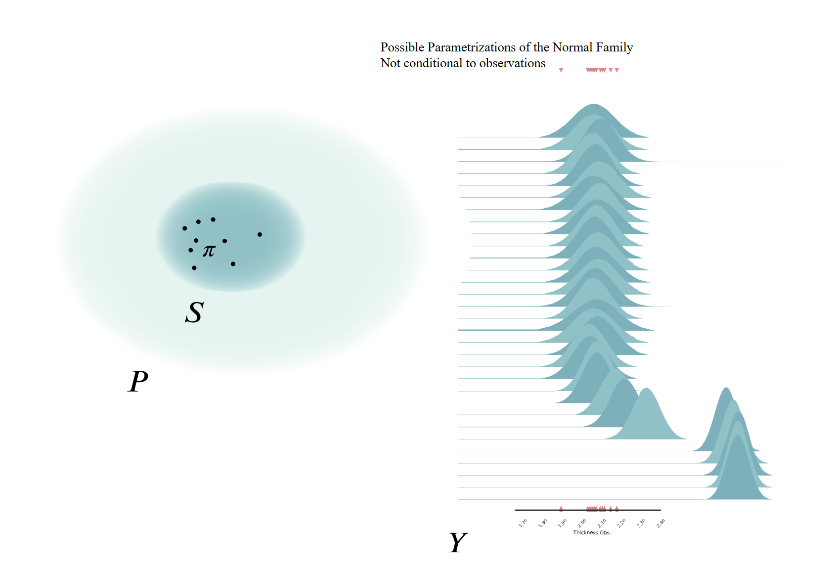
In the dynamic and often uncertain realm of subsurface exploration, probabilistic modeling emerges as a key tool. This section delves into the application of Bayesian Statistics and probabilistic approaches to address the inherent uncertainties in subsurface data. Here’s what you’ll learn:
Embracing Uncertainty: Gain an understanding of how to quantify and incorporate uncertainty in geological models. We focus on aleatoric uncertainty, which represents the inherent variability in subsurface data.
Bayesian Methods with Pyro: Discover how to apply Bayesian statistical methods using Pyro, a powerful probabilistic programming framework. These tutorials will guide you through the process of encoding uncertainty in your models, offering a robust way to handle complex geological data.
Integrating Structural Uncertainty: Learn to integrate structural uncertainty into your models using GemPy. This approach enhances the realism and reliability of your geological interpretations.
Probabilistic Inversions: Explore how geophysical data can be used as observational constraints in probabilistic inversions. This technique allows for a more comprehensive understanding of subsurface structures by incorporating both geophysical measurements and geological knowledge.
Petrophysical Data Integration and Modeling
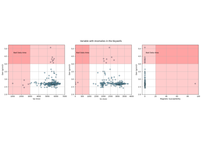
The scarcity and uneven distribution of petrophysical data pose significant challenges in the mining industry, affecting exploration and resource development efforts. This section introduces workflows designed to address these challenges using open-source Python tools for data exploration, integration, and modeling. Through a detailed case study of cores from Collinstown, Ireland, we showcase how these tools enable researchers to work with diverse data types, including legacy datasets and modern petrophysical measurements.
Here’s what you’ll learn:
Exploratory Data Analysis (EDA): Gain insights into the process of integrating and analyzing petrophysical data alongside related datasets such as geochemistry, stratigraphy, and geophysical surveys.
Data Gap Filling: Learn techniques for addressing missing or incomplete data using standard and machine-learning-based approaches.
Practical Application: Explore how these workflows are applied to real-world data to enhance understanding of geological anomalies and support subsurface modeling efforts.
By the end of this section, you’ll understand how to leverage these tools to tackle the challenges of sparse and incomplete data in mining, driving more accurate and informed decision-making.
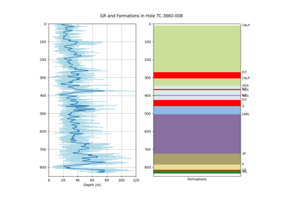
Modelling and Propagation of Legacy Petrophysical Data for Mining Exploration (1/3)
Modeling and Propagation of Petrophysical Data for Mining Exploration (2/3)
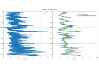
Modelling and Propagation of Legacy Petrophysical Data for Mining Exploration (3/3)
Bayesian Inference Theory
Here you will find a collection of examples that demonstrate the basics of Bayesian inference theory and how to apply it to geology using Pyro.
Requirements
The requirements for the core functionality of the package are:
.
numpy
matplotlib
python-dotenv
Optional requirements
There are many optional requirements, depending on the data format you want to
read/write. Currently, the requirements_opt.txt reads like:
git+https://github.com/terranigma-solutions/subsurface.git#egg=subsurface
omfvista
pyvista

simpeg
discretize

# petrophysics
tabulate
seaborn
scikit-learn
xgboost

# geophysics
git+https://github.com/hifexplo/hylite.git
Acknowledgements
This project has received funding from the European Union‘s Horizon Europe research and innovation programme under grant agreement No 101058483
Funded by the European Union. Views and opinions expressed are however those of the author(s) only and do not necessarily reflect those of the European Union or Horizon Europe research and innovation programme