Note
Go to the end to download the full example code
Reading Model 1 OMF Project into Subsurface
This tutorial demonstrates how to read an OMF (Open Mining Format) project file and convert it into a Subsurface format for enhanced analysis and visualization.
Importing Required Libraries
Begin by importing the necessary libraries for this tutorial.
import pandas as pd
import pyvista
import xarray

import subsurface
from subsurface import TriSurf, LineSet
from subsurface.modules.visualization import to_pyvista_mesh, to_pyvista_line, init_plotter
from vector_geology.utils import load_omf
Loading the OMF Project
Load the OMF project file using a custom function.
omf = load_omf("PATH_TO_MODEL_1")
Visualizing the OMF Project with PyVista
Next, we use PyVista for an initial visualization of the OMF project.
# Replace `False` with a condition or toggle to enable plotting.
if False:
    omf.plot(multi_colors=True, show_edges=True, notebook=False)
Visualizing Unstructured Data with Subsurface and PyVista
Use Subsurface and PyVista to visualize the unstructured data.
meshes_far = []

meshes = []
lines_1 = []
lines_far = []

dataset: xarray.Dataset = None

for e in range(omf.n_blocks):
    block_name = omf.get_block_name(e)
    print(block_name)
    polydata_obj: pyvista.PolyData = omf[block_name]
    # Check if the polydata is a mesh and if is not continue
    print(polydata_obj.get_cell(0).type)
    unstruct_pyvista: pyvista.UnstructuredGrid = polydata_obj.cast_to_unstructured_grid()

    grid = unstruct_pyvista
    cell_data = {name: grid.cell_data[name] for name in grid.cell_data}
    match polydata_obj.get_cell(0).type:
        case pyvista.CellType.TRIANGLE:
            cells_pyvista = unstruct_pyvista.cells.reshape(-1, 4)[:, 1:]
            new_cell_data = {
                **{
                    "Formation_Major_": e,
                },
                **cell_data
            }
            unstruct: subsurface.UnstructuredData = subsurface.UnstructuredData.from_array(
                vertex=unstruct_pyvista.points,
                cells=cells_pyvista,
                cells_attr=pd.DataFrame(new_cell_data)
            )

            ts = TriSurf(mesh=unstruct)
            s = to_pyvista_mesh(ts)
            if e == 5:
                meshes_far.append(s)  # * This mesh is far from the rest. I am still unsure what is meant to represent.
            else:
                if False:
                    to_netcdf(
                        base_data=unstruct,
                        path=f"./{block_name}.nc",
                    )
                meshes.append(s)


        case pyvista.CellType.LINE:
            if e > 11: continue
            continue # To ignore wells for now
            cells_pyvista = unstruct_pyvista.cells.reshape(-1, 3)[:, 1:]
            unstruct: subsurface.UnstructuredData = subsurface.UnstructuredData.from_array(
                vertex=unstruct_pyvista.points,
                cells=cells_pyvista,
                cells_attr=pd.DataFrame(cell_data)
            )
            line = LineSet(data=unstruct)
            s = to_pyvista_line(line, radius=100, as_tube=True, spline=False)
            if e <= 10:
                lines_1.append(s)
            elif e <= 11:
                lines_far.append(s)

if False:  # Replace with condition for exporting to Liquid Earth
    base_structs_to_binary_file("leapfrog1", unstruct)
Stonepark_DIA
CellType.TRIANGLE
Stonepark_OB
CellType.TRIANGLE
Stonepark_ORS
CellType.TRIANGLE
Stonepark_Limerick_Seismic
CellType.LINE
Stonepark_HBL
CellType.TRIANGLE
Stonepark_Waulsortian_regional
CellType.TRIANGLE
Stonepark_ABL
CellType.TRIANGLE
Stonepark_KKR
CellType.TRIANGLE
Stonepark_WAL
CellType.TRIANGLE
collar
CellType.VERTEX
Topography
CellType.TRIANGLE
DHD_Stonepark_Breccia
CellType.LINE
Stonepark_Topography
CellType.TRIANGLE
DHD_Stonepark_Assays
CellType.LINE
DHD_Stonepark_Litho
CellType.LINE
Stonepark_LGR
CellType.TRIANGLE
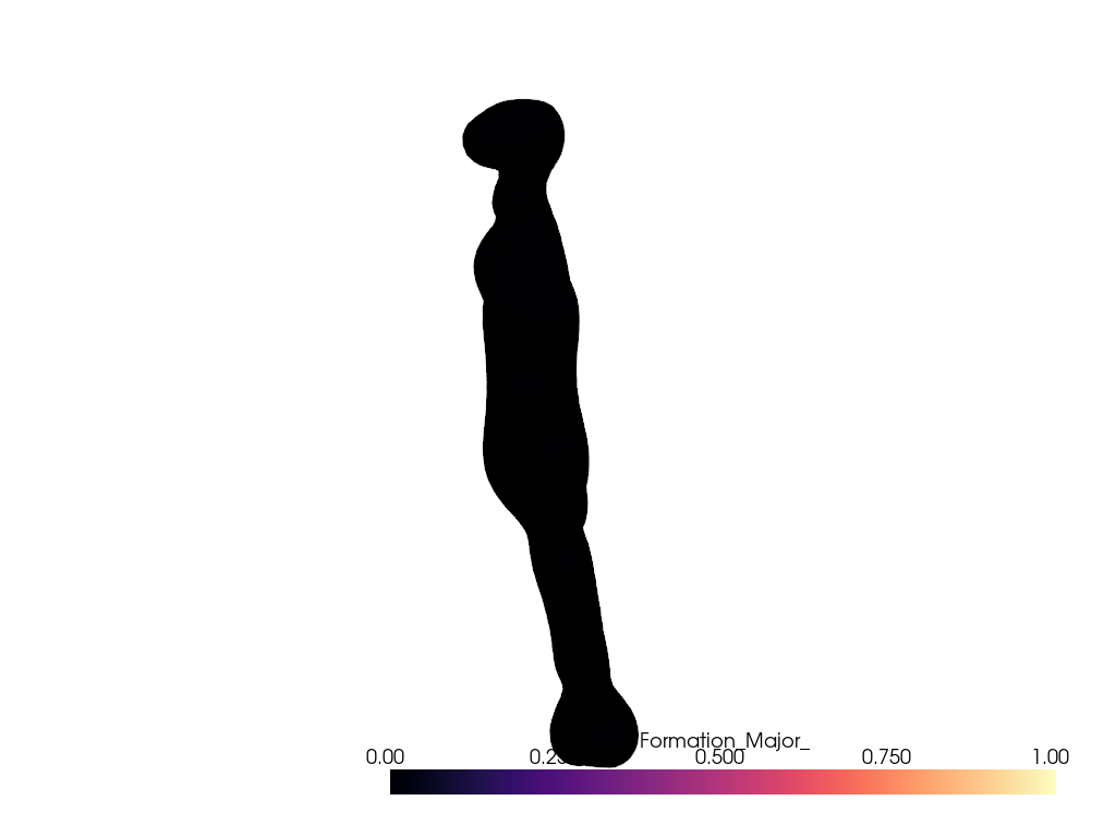
Visualize Unstructured Data:
Use Subsurface and PyVista to visualize the unstructured data.
plotter = init_plotter()
if plot_model_area := True:
    for mesh in meshes[:1]:
        plotter.add_mesh(mesh, cmap="magma", opacity=1)

    for line in lines_far:
        plotter.add_mesh(line, cmap="viridis", opacity=1)
else:
    # * This seems to go together
    for mesh in meshes_far:
        plotter.add_mesh(mesh, cmap="magma", opacity=0.7)

    for line in lines_1:
        plotter.add_mesh(line, cmap="viridis", opacity=1)

plotter.show()
Conclusions
It seems that there are two areas in the OMF but the second one does not match the Legacy report. On the second area, wells do not have lithological data so there is not much we can do with it. For now we will use the interpreted meshes to reconstruct the gempy model Lithology data and gravity seems to be confidential so how much we can share in this documentation will be limited.
Total running time of the script: (0 minutes 6.341 seconds)